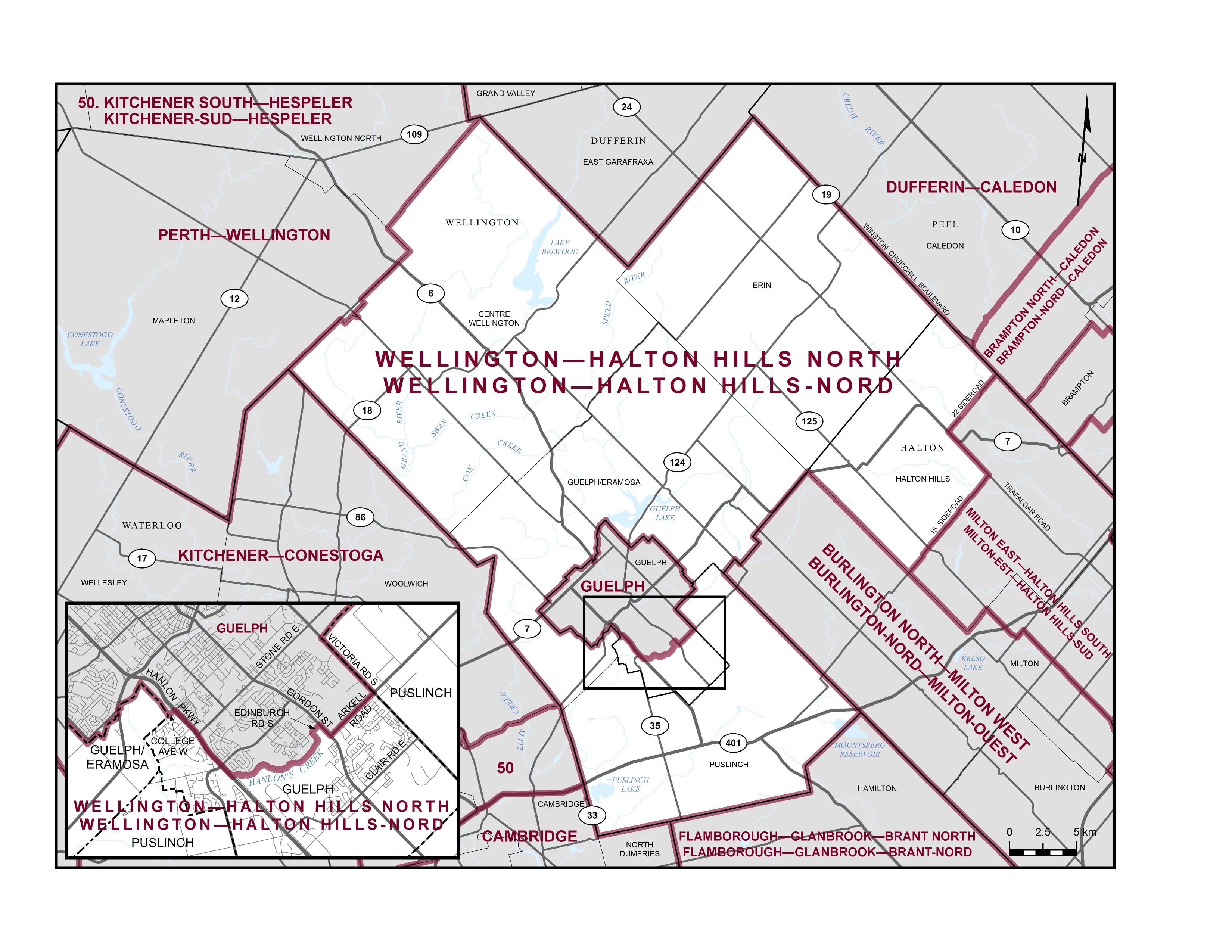
The Electoral District (or riding) of Wellington-Halton Hills North consists of:
- that part of the City of Guelph lying southeasterly of a line described as follows: commencing at the intersection of the southwesterly limit of said city and College Avenue West; thence northeasterly along said avenue to Hanlon Parkway; thence southeasterly along said parkway to Hanlon's Creek; thence generally northeasterly and northwesterly along said creek to Edinburgh Road South; thence northeasterly along said road to Gordon Street; thence southeasterly along said street to Arkell Road; thence northeasterly along said road to the northeasterly limit of said city (Victoria Road South);
- the Town of Erin;
- that part of the Town of Halton Hills lying northwesterly of a line described as follows: commencing at the intersection of the southwesterly limit of said town (Nassagaweya-Esquesing Townline) and 15 Side Road; thence generally northeasterly along said road to Trafalgar Road; thence northwesterly along said road and Highway 7 to 22 Side Road; thence northeasterly along said road and its intermittent production to the northeasterly limit of said town (Winston Churchill Boulevard); and
- the townships of Centre Wellington, Guelph/Eramosa and Puslinch.
Township of Centre Wellington
Township of Guelph-Eramosa
Township of Puslinch
Town of Erin
Town of Halton Hills
Below is a map that outlines the electoral district (riding) boundaries for Wellington-Halton Hills North. 35115 (elections.ca)
You can also find more information about our electoral district by going to the Elections Canada web site.